Webster Pacific has developed proprietary methods to create demographic, wealth, and road network data in over 40 international markets. Please contact steve@websterpacific.com for a sample dataset or a demo.

Data Offerings

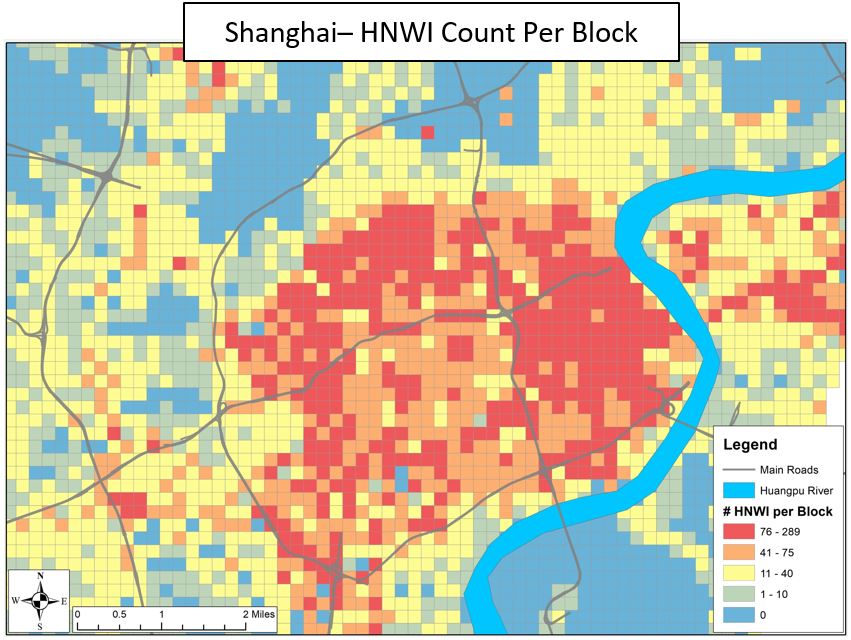
Asset Band and Population Data Blocks

Description:

  • This data set estimates population by asset band and population by age in metro areas around the world.
  • Data is provided in thousands of “Data Blocks,” each of which are micro-geographic squares of 250 meters per side. For reference, the 5 boroughs of New York City have about 12,000 Data Blocks.
  • Data is produced through a proprietary combination of demographics, traffic-accurate road networks, residential real estate prices, and macro-Asset Band estimates.

Asset Bands:

  • HNWI – Greater Than $1MM USD Net Assets
  • Mass Affluent – $100k to $1MM USD Net Assets
  • Emerging Affluent – $25k to $100k USD Net Assets
  • Mass Market – Less Than $25k USD Net Assets

Data Fields:

  • Population by asset band & population by 5-year age group within each 250-m block (raw)
  • Population by asset band per block within travel times of 10-min walk, 10-min drive, 20-min drive or custom.

Pricing:

  • $2,500 to $10,000 per metro area depending on Data Fields purchased and number of metro areas purchased

2000 US Census Tract Data in 2010 Geographies

Description:
This data set estimates the 2000 US Decennial Census Data in 2010 Census Geographies.  Data is produced via census geographic crosswalks and proprietary analytics.

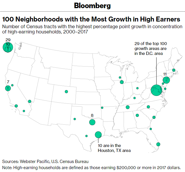
This data is featured by Bloomberg, here: https://bloomberg.com/news/features/2018-12-18/these-are-the-neighborhoods-attracting-america-s-richest

Data:

  • CSV File of all 2010 Census Tract GeoID with estimates of:
    • Total Population – 2000
    • Total Households – 2000
    • Households by Income – 2000
    • Households by Income Adjusted for Inflation – 2000
    • More variables available upon request
  • American Community Survey (ACS) data of the same variables
  • National GIS File of 2010 Census Tracts

Pricing:
$2,000 to $4,000 depending on Data purchased.

Traffic Accurate Road Networks

Description:
These road networks can be used to create drive-time catchments and route plans, along with a variety of other analyses.  The road networks are statistically tested to simulate actual drive-times at particular times of the day or week.

Data: 

  • The road network, in the form of a geodatabase, which covers the wider metro area of a particular market
  • The geodatabases typically include several hundred thousand road segments, each with fields for segment length and traffic-adjusted road speed